Alzeau water inlet
and the Montagne Noire channel
The Montagne Noire channel is the very heart of the ingenious hydraulic system designed by Pierre-Paul Riquet. This is the channel that carries the water collected from the Montagne Noire region to the Atlantic basin.
The Montagne Noire, the Canal du Midi source
The plans to supply water to the Canal du Midi designed by Riquet involved collecting water from various streams in the Montagne Noire region and carrying this water via a channel to the Seuil de Naurouze, the highest point of the canal.
That is why we consider that the channel in the Montagne Noire is the actual 'source' of the Canal du Midi.
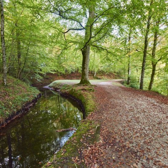
The channel in the Montagne Noire is a small channel, 2 to 3 m wide and 24 km long. It flows across the French departments of Tarn (Arfons and Les Cammazes) and Aude (Saissac and Villemagne).
The start of the Montagne Noire channel at Alzeau water inlet
The challenge of finding a water supply for the Canal du Midi
Supplying water to the Canal du Midi was a real challenge, and Riquet really rose to the occasion. To overcome this challenge, it was necessary to find a way to carry the water from the Montagne Noire to the watershed point, via the hamlet of Conquet. To do so, Riquet came up with the idea of building a channel!
The Montagne Noire channel starts at over 680 m above sea level, at the Alzeau torrent in the town of Arfons. This is known as the Alzeau water inlet.
But it is not only the Alzeau that provides the water for the mountain channel. This channel also carries the water from other streams in the Mediterranean basin of the Montagne Noire region (Alzeau, Bernassonne, Lampy, Rieutort, etc.).
From the highlands of the Montagne Noire, the channel follows a gentle slope down through the mountains and it is possible to walk alongside it.
Alzeau guard house
All the way along the channel, there are guard houses. They were used as lodgings for the employees in charge of monitoring and operating the engineering structures on the channel.
In 1850, the Alzeau guard house was built. It was actually the second time a house was built at this spot, the first one being built in around 1720 for the guardian of the water inlet.
Lampy-Neuf lake was built between 1777 and 1782, 13 km from Alzeau water inlet, at 610 m above sea level.
Did you know?
There is a stone memorial here dating from 1837, ordered by the Duke of Caraman. It tells the story of the creation of the Canal du Midi from its departure point (Alzeau water inlet).

Monument Riquet à Alzau
The hamlet of Conquet
The hamlet of Conquet is 4 km away from Alzeau water inlet, 621 m above sea level.
It was at the hamlet of Conquet that Pierre-Paul Riquet decided to end the mountain channel.
From there, the water collected by the mountain channel flows naturally down the Sor valley on the Atlantic side of the mountain, and into the Rigole de la Plaine.
Vauban and the extension of the mountain channel
Part of Vauban's improvement programme for Riquet's canal was to guide the waters from the Montagne Noire as far as Saint-Ferréol. But extending the mountain channel on the north side would involve crossing through the ridge line from one side to the other.
An extension of this mountain channel would add to the water from Laudot stream. Back then, this was the only stream supplying Saint-Ferréol lake.
Cammazes tunnel, a risky plan
This 120-m-long tunnel is near Cammazes lake, 5 km after the hamlet of Conquet, and supplies additional water to Saint-Ferréol lake.
Vauban tunnel, also known as Cammazes tunnel was built between 1687 and 1688, and was a bold decision! Antoine de Niquet, regional commissioner for the Kingdom's fortifications for Languedoc, Provence and Dauphiné was entrusted with the project.
Hundreds of labourers were employed to build the tunnel. In April 1687, there was a serious accident that killed six people and injured three. Despite the sheer scale and difficulty of the construction, the tunnel was completed in two years!
In 1846, trees were planted on the top of the tunnel entrance. This helped the structure blend into its surroundings. The following year, a guard house for Cammazes tunnel employees was built, at the beginning of the channel path. This house was lived in for a very long time, but has been abandoned for a few years now.
Did you know?
When the Vauban tunnel was built, there were two sculptural façades that dedicated the creation of the structure to the Sun King. The sculpted panels were destroyed during the French Revolution.
Cammazes reservoir
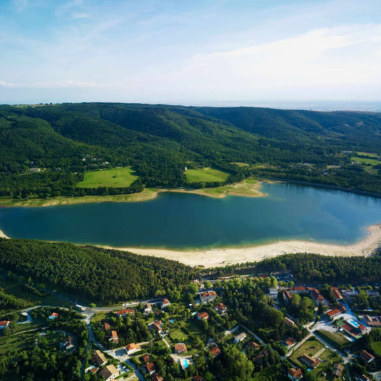
Cammazes reservoir, or dam, is a huge reservoir with a capacity of over 20 million m3 and a circumference of 15 km, used to regulate the Sors waterway.
When it was completed in 1958, the reservoir was used for irrigation and as a supply of drinking water. Some of the waters from Riquet's hydraulic network also pass through here.


